Zonal or grid-based selection?
Which method of soil sampling is better, zone or grid? What data should be used to allocate zones?
Today, there is no consensus among farmers on how to sample for precision agriculture. There are two camps, the first is the grid supporters, the second is the zone sampling supporters.
With grid sampling, everything is simple: you choose the optimal grid size for your economic and technical capabilities, according to which you want to do precision farming, put it on the field contour and work.
With zonal selection, everything is not so simple and unambiguous. First of all, we need to understand what we are going to start from when defining the zones for sampling.
We offer the following options: Yield maps. Based on relief maps. By ndvi maps.
If you have a history of yields in your field and from year to year you see that some areas in your field produce low yields on different crops, you divide such zones separately. But for more accurate creation of zonal selection maps, you should also overlay the yield map with relief maps and ndvi maps. Visually, you should see the similarity of the zones on these maps, for example, a visual change in soil type, and then we can be sure of the zones that we select for analysis.
There is also a way to define zones by organic matter content, pH and electrical conductivity. In this case, it is necessary to have the values of these parameters with a high frequency of measurement in the field.
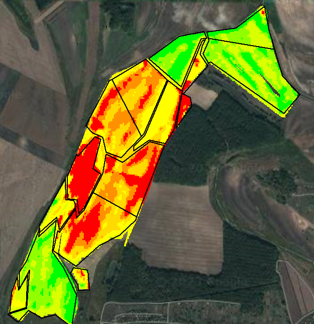
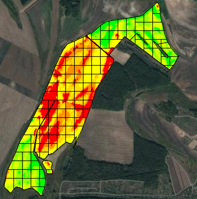
Below is an example in which the yield map is overlaid with the 1-hectare grid and zone selection maps.
Write to us
and we will find an opportunity
for cooperation

